Dig Once, Map Together: The November Soil Census That Beats Guesswork
Most of us treat soil like the wallpaper of growing: it is there, it holds things up, and we only notice it when something goes wrong. We test one bed with a cheap pH kit, dig a hole, squeeze a handful, and quietly decide that the whole plot behaves the same way. It rarely does. An allotment site is a patchwork of old bonfire spots, buried paths, clay pockets, sandier corners and decades of other people's compost. If you are planning next year's beds, paths and water storage, one sample is not a survey. It is a guess with good intentions.
November is a good month to stop guessing. The soil is usually damp enough to work, the worms are still reasonably active, and the growing season has loosened its grip on our weekends. Better still, a soil census is the sort of job that shrinks when people do it together. One grower with a jam jar is doing a school science project. Twelve growers with jam jars, a shared map and a tea urn are doing community science.
Why one bed is never the whole story
Soil variation on an allotment site is often hidden in plain sight. The bed by the gate may be compacted from years of wheelbarrows. The corner behind the shed might be deep, friable and full of worms because someone used to keep chickens there. A low spot can hold winter water for weeks, while a raised strip nearby drains before you have finished your flask. None of this shows up if you only ever test the bed you happen to be standing in.
A site-wide census does two useful things at once. It gives you better information for planning, and it gives neighbouring growers a reason to compare notes without holding a formal meeting. That matters. Community growing works best when knowledge is shared in practical, slightly muddy ways, not when it lives in one person's notebook or a folder nobody opens.
The kit: about fifteen quid and a lot of jam jars
You do not need laboratory equipment. You need repetition, consistency and somewhere to put the results. For a site of twenty to forty plots, aim for one sample point per plot, plus a few shared areas such as paths, hedges and the communal water butt.
- Clear jam jars with lids, one per sample point
- A trowel and a sturdy garden fork
- A ruler or tape measure
- A stopwatch, or a phone timer
- A metal rod, long screwdriver or piece of stiff wire for probing compaction
- A bottomless tin can for infiltration tests
- Water in a bottle or watering can
- A tray or sheet of cardboard for worm counts
- A printed site map, clipboard and pencil, or a shared online form
If someone has a pH kit, bring it, but do not let it dominate the day. Texture, drainage, compaction and worm activity will tell you more about how the soil behaves than a single number ever will.
Four tests, one afternoon
Divide into pairs. Each pair takes a zone, follows the same method and records the same fields. The point is not perfection; it is comparison.
1. The texture jar
Fill a clear jar one-third full with soil, top it up with water, add a pinch of salt if you like, and shake it hard. Leave it to settle. Sand drops out first, then silt, then clay. Mark the layers after an hour and again the next morning. A rough percentage estimate is enough: sandy, silty, clay-heavy or reasonably balanced. Photograph the jar with its sample label in shot.
2. The infiltration test
Push a bottomless tin can a few centimetres into the soil, pour in about 2.5cm of water and time how long it takes to disappear. Do this three times in the same spot, topping up each time. If water sits there for half an hour, you have found a drainage problem worth mapping. If it vanishes almost immediately, you may be on a free-draining, droughty patch.
3. The earthworm count
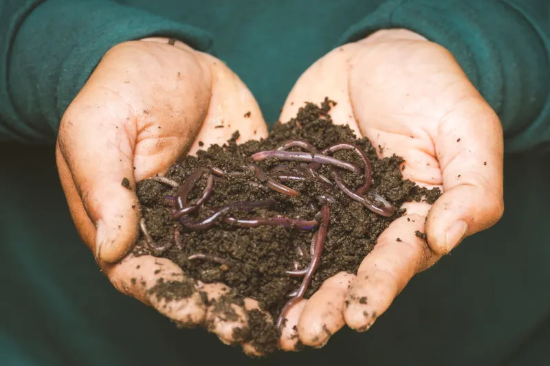
Mark out a 25cm square, dig out a block about 25cm deep and sort it through your hands or onto a tray. Count the earthworms you find in ten minutes. Put them back gently. This is not a full biodiversity survey, but it is a useful indicator of biological activity. A bed with almost no worms is telling you something.
4. The compaction probe
Push a metal rod into the soil with steady, consistent pressure and mark how far it goes before it stops. Do this at several points along paths, bed edges and the middle of beds. If the rod refuses to go deeper than a few centimetres, note it. Compacted paths and bed edges are common on older sites, and they quietly affect drainage and root growth.
Running the day without turning it into a committee
Pick a Saturday, advertise it on the site noticeboard and bring a flask. Start at ten, pair people up, hand out zones and demonstrate each test once. Keep the method sheet short enough to read with cold hands. Ask each pair to label their samples clearly and return their recording sheet by lunchtime, or whenever the light starts going.
It helps to have one person looking after the map and one person looking after the tea. That is the whole organisational structure. Avoid the temptation to create a steering group before anyone has dug a hole. The census is the meeting.
Turning mud into a map
Pool the results afterwards, either on a large paper map pinned up in the shed or in a simple shared spreadsheet. Use coloured dots for texture, drainage, compaction and worm counts. Patterns will emerge quickly: the wet corner, the hard path, the bed that drains too fast, the strip where nothing seems to live.
That map then becomes a planning tool for 2027. You can decide where to put hungry crops, where to build raised beds, where to site extra water butts, and where to avoid digging wet clay in winter. You can plan deep-rooted green manures for compacted patches and mulch for exposed, sandy spots. You can also compare notes with neighbours about what grew well where, which is often the most useful data of all.
Run it again next November and you have a baseline. Run it for three years and you have something genuinely valuable: a record of how your site behaves, made by the people who grow on it.
The quiet point of it all
A soil census will not fix every problem on an allotment site. It will not settle the great debate about the communal skip, and it will not make the council answer emails faster. But it does something modest and radical: it turns a solitary winter job into shared knowledge. It gives growers a reason to knock on each other's gates, compare a jar of muddy water and plan together for the year ahead.
That is community science in its most useful form. No lab coat, no grant application, no expert at the front. Just a few neighbours, a Saturday in November and a map that belongs to everyone who helped make it.